Modèle:TopoNew
Un article de GrandTerrier.
(Différences entre les versions)
| Version du 12 mars ~ meurzh 2012 à 18:25 (modifier) GdTerrier (Discuter | contributions) (New page: <hr>__NUMBERHEADINGS____NOTOC__ {|width=870 |colspan=3 style="background-color: black;"|<center><font color=white>'''T O P O N Y M I E'''</font></center> |- |width=15% valign=top|<center><...) ← Différence précédente |
Version actuelle (25 avril ~ ebrel 2014 à 20:31) (modifier) (undo) GdTerrier (Discuter | contributions) |
||
| (16 intermediate revisions not shown.) | |||
| Ligne 1: | Ligne 1: | ||
| - | <hr>__NUMBERHEADINGS____NOTOC__ | ||
| {|width=870 | {|width=870 | ||
| - | |colspan=3 style="background-color: black;"|<center><font color=white>'''T O P O N Y M I E'''</font></center> | + | |width=30% valign=top|<imagemap>Image:PanneauTopo.jpg|220px |
| - | |- | + | default [[Category:Toponymie]] |
| - | |width=15% valign=top|<center><small>Microtoponymie : <br>[[:Category:Cadastre1834|[Cadastre de 1834]]]</small></center> | + | desc none</imagemap> |
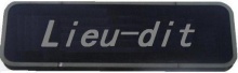
| - | |width=70% valign=top|<center><small>Cartes anciennes : <br>[[:Category:Cartographie|[Cartographie]]]</small></center> | + | <br><br><imagemap>Image:Panneau_lieu-dit.jpg|220px |
| - | |width=15% valign=top|<center><small>Index/résumé : <br>[http://{{SERVERNAME}}/wiki/index.php?title=Special:Topo [Tous toponymes]]</small></center> | + | default [[Category:Toponymie]] |
| - | |} | + | desc none</imagemap> |
| - | <hr> | + | |
| - | {|width=870 | + | |
| - | |width=15% valign=top|[[Image:MicroTopo.jpg|center|frame|100px]] | + | |
| |width=70% valign=top| | |width=70% valign=top| | ||
| {| align="center" border="1" rules="all" width="600" cellpadding="4" cellspacing="0" style="clear: right; margin: 0 0 1em 1em; border: 1px solid #999; border-right-width: 2px; border-bottom-width: 2px; background-color: white;" | {| align="center" border="1" rules="all" width="600" cellpadding="4" cellspacing="0" style="clear: right; margin: 0 0 1em 1em; border: 1px solid #999; border-right-width: 2px; border-bottom-width: 2px; background-color: white;" | ||
| Ligne 26: | Ligne 22: | ||
| |valign="top"|<b>Relevés</b> | |valign="top"|<b>Relevés</b> | ||
| |{{#if:{{{releves|}}}|{{{releves}}}|?}} | |{{#if:{{{releves|}}}|{{{releves}}}|?}} | ||
| - | |- | ||
| - | |valign="top"|<b>Localisation</b> | ||
| - | |{{#dec2dms:{{{lat}}}|{{{lon}}}}} (lat. {{{lat}}}, long. {{{lon}}}) | ||
| - | |} | ||
| - | |width=15% valign=top|<center><imagemap>Image:Topo.jpg | ||
| - | default [[Category:Toponymie]] | ||
| - | desc none</imagemap></center> | ||
| - | |} | ||
| - | <hr> | ||
| - | {| | ||
| - | |width=17%|{{#if:{{{frtopo2|}}}|[[Image:P2-{{{frtopo2}}}.jpg|thumb|170px|left]]| }} | ||
| - | |width=56%|{{#if:{{{frtopo2|}}}|[[Image:P1-{{{frtopo2}}}.png|350px|center]]| }} | ||
| - | |width=17%|{{#if:{{{image2|}}}|[[Image:{{{image2}}}|150px|right]]|{{#if:{{{frtopo2|}}}|[[Image:P2-{{{frtopo2}}}.jpg|thumb|170px|right]]| }}}} | ||
| |} | |} | ||
| - | ==Localisation du lieu-dit== | + | :Référentiel : {{Tpg2|:Category:Cartographie|Cartographie, cartes anciennes}} « [http://{{SERVERNAME}}/wiki/index.php?title=Special:Topo Index des toponymes] » {{Tpg2|ROUZ Bernez - Les noms de lieux d'Ergué-Gabéric|Étude de Bernez Rouz sur les noms de lieux d'Ergué-Gabéric}}{{Tpg2|DESHAYES Albert - Dictionnaire des noms de lieux bretons|Dictionnaire des noms de lieux bretons d'Albert Deshayes}} |
| - | ===Aujourd'hui sur Google=== | + | |}__NUMBERHEADINGS____NOTOC__ |
| - | {{GoGoo|lat={{{lat}}}|lon={{{lon}}}}} | + | |
| + | ==Géolocalisation du village== | ||
| + | |||
| + | Coordonnées géographiques : {{#dec2dms:{{{lat}}}|{{{lon}}}}} (lat. {{{lat}}}, long. {{{lon}}}) | ||
| + | |||
| + | Cartographie du lieu-dit : « [[Géo.{{{frtopo}}}]] » | ||
Version actuelle
  |
|
[modifier] Géolocalisation du village
Coordonnées géographiques : 0° 0' 0" N 0° 0' 0" W (lat. {{{lat}}}, long. {{{lon}}})
Cartographie du lieu-dit : « [[Géo.{{{frtopo}}}]] »